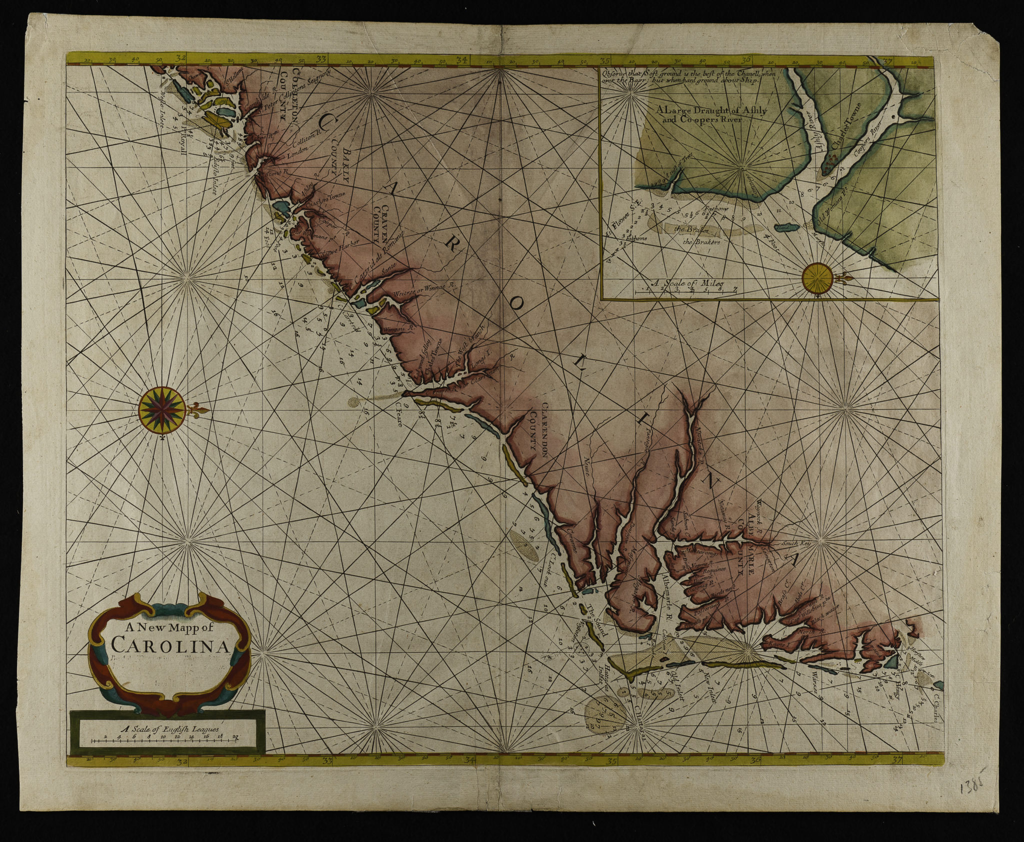
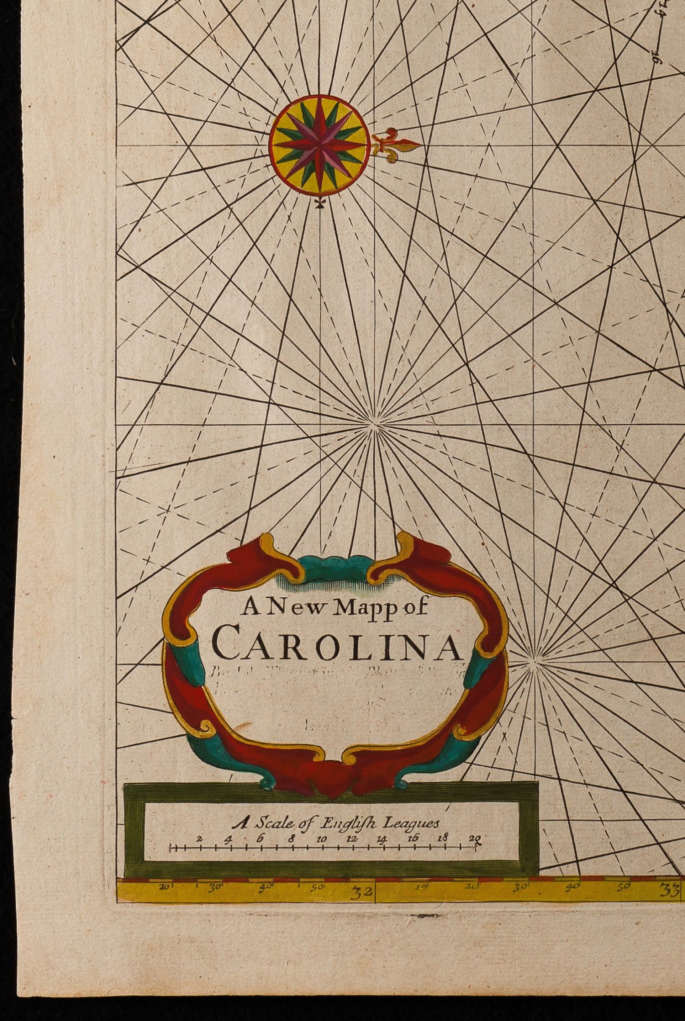
A New Mapp of Carolina By John Thornton … and Will: Fisher
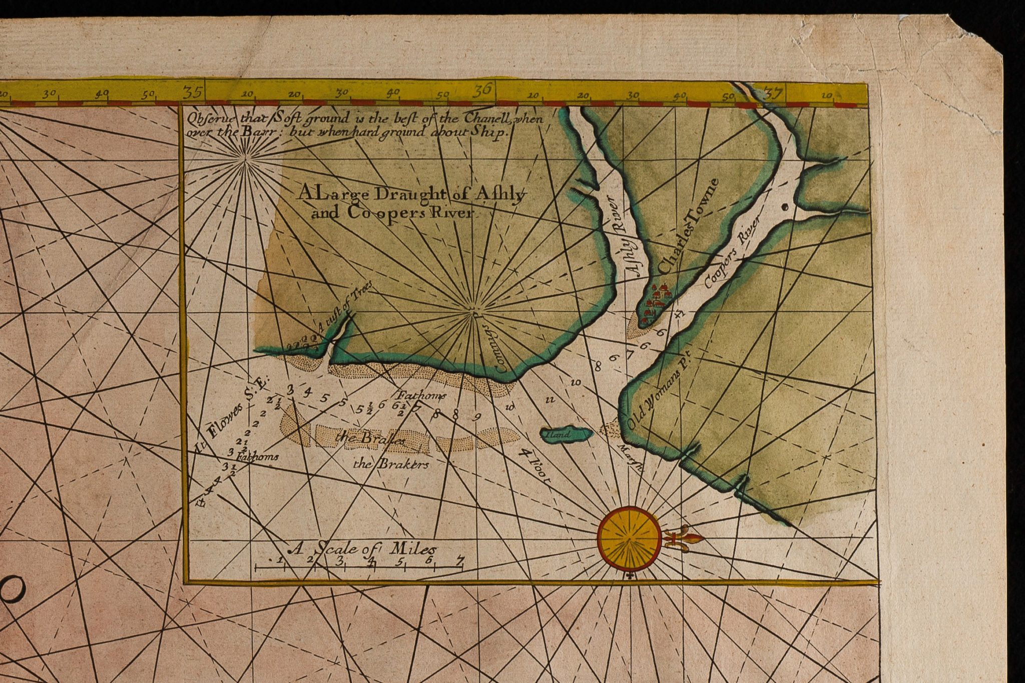
Inset: A Large Draught of Ashly and Coopers River
First published in 1689 in the Fourth Book of the English Pilot
London, C. 1728
18.5 x 23” overall
(The altered script in the cartouche dates to the 1728 edition placing this copy to that edition or later.)
William Cumming described this map as the most important chart to the colonizers and early maritime traders of North Carolina. It was ” published in 1689 in the Fourth Book of the English Pilot. Thornton, John, 1641-1708;Fisher, William, fl. 1657-1690.
Unfortunately, it was full of errors and inaccuracies-unfortunate, because The English Pilot was the Bible of English mariners; and the Fourth Book, of prime importance in the history of American cartography, contained the first great collection of charts of British (not Dutch or German) origin delineating the coast of America. Many of its American coastal charts were repeatedly and extensively revised, but the Carolina map was reprinted and even reengraved without improvement. Its inaccuracies were very dangerous to attempted navigation in those waters: its “Corituck” and “New Inlet” were inlets not usable . . . “Roanoke Inlet” was erroneously put opposite Colleton Island and called “Old Inlet,” and Roanoke Island itself was portrayed as a small islet hugging the mainland shore. Cape Lookout was shown as barely a protuberance, with shoal water, along the Outer Banks; and the only settlements noted were “Capt. Willobies P.ta” on Currituck Sound and “Charles Town,” a temporary and soon abandoned settlement of the 1660’s on the Cape Fear River.
A handsome example of a scarce and important map of the Carolina coast in very good overall condition. Repaired tear in upper right corner and 2”-3” reinforcement to bottom of center fold. Hand color.