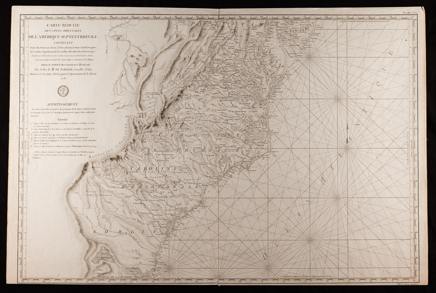
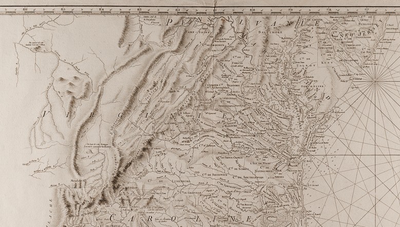
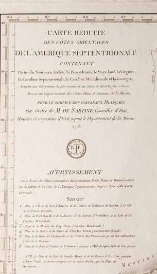
Carte Reduite Des Cotes Orientales De L’Amerique Septentrionale…
Antoine Sartine (1729-1801)
23 ¾ ” x 35 1/2”.
First published 1778, “VAISSEAUX DU ROI”
Reissued C. 1792, Post French Revolution “VAISSEAUX FRANCAIS”
Published by the French Admiralty, Antoine Sartine’s Carte Reduite (published under his tenure as Secretary of State for the Navy) is among the finest maps of the Southeast of the Revolutionary War period. Issued in “Neptune americo-septentrional” by the Depot General de la Marine, the official French Government agency of nautical charts, this finely engraved and highly detailed map extends from Philadelphia south to the mouth of the St. John River at Jacksonville, Florida.
The 1793 edition – after the French Revolution – is the second state with the initials RF replacing the fleur-de-lis in the Depot de la Marine Stamp.
PRICE: $3,200.