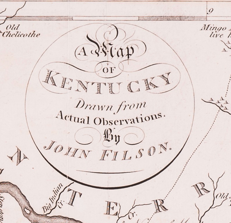
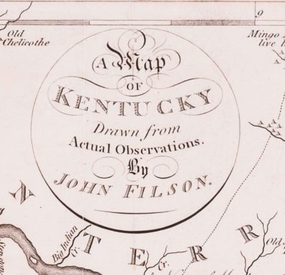
 A Map of Kentucky Drawn from Actual Observations
By John Filson (1747- 1788)
Copperplate engraving on wove paper
Published by John Stockdale
London
1793
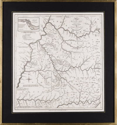
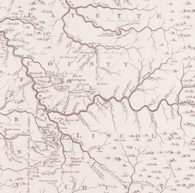
John Filson’s map of Kentucky, first published in Wilmington DE in 1784, was issued in a very limited printing and is virtually unobtainable. The map and the history of Kentucky (The Discovery, Settlement and Present State of Kentucke) which it accompanied were critical in generating interest among Americans regarding the opportunities in the developing state and is today seen as a milestone in the state’s history. George Washington, with his interest in the development of the Ohio River Valley, owned a copy, now in the collection of the Boston Athenaeum, and corresponded with Filson. The initial printing of the map and history, probably about 1500 copies, was quickly sold out and, while Filson contemplated another printing, none seems to have taken place.
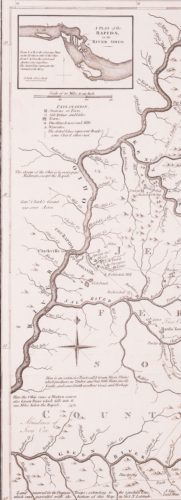
Editions quickly followed in French (Paris, 1785) and in German, (Leipzig, 1790) but on a much-reduced format. It was not until John Stockdale, a London publisher, produced a slightly revised edition in 1793 that a full-size version of Filson’s seminal map would become more broadly available again. The Stockdale map included an important additional inset showing “A Plan of the Rapids in the Ohio River” and appeared both in his edition of Filson’s history and in Morse’s 1794 American Atlas.
John Filson’s map goes into great detail naming major streams and many of their tributaries. It also shows the location of trails, forts, settlements, salt licks and other important landmarks. Sites of major events are noted as are the locations of the domiciles of numerous prominent settlers. The level of detail of specific and vital interests to those actually settling Kentucky rendered the map indispensable and leave no doubt that Filson did draw his map from actual observation.
There is not a great deal known about John Filson’s life or the efforts that led to his history and map. The most complete source of information remains R.C. Thruston Ballard’s article in the Filson Club Historical Quarterly, January 1934. Born in 1747 in Chester County PA, Filson served in the Revolutionary War and was taken prisoner during the Battle of New York in 1776. After the war, he worked as a surveyor and moved to Kentucky in the early 1780s settling near Lexington. He became a partner in a large tract of land that would later become Cincinnati, named in honor of the Society and its founder George Washington.
The map is in excellent condition and has been professionally cleaned and deacidified. The left side margin has been extended slightly to replace areas of loss where it was attached to the binding. Several small tears and losses were addressed during conservation.