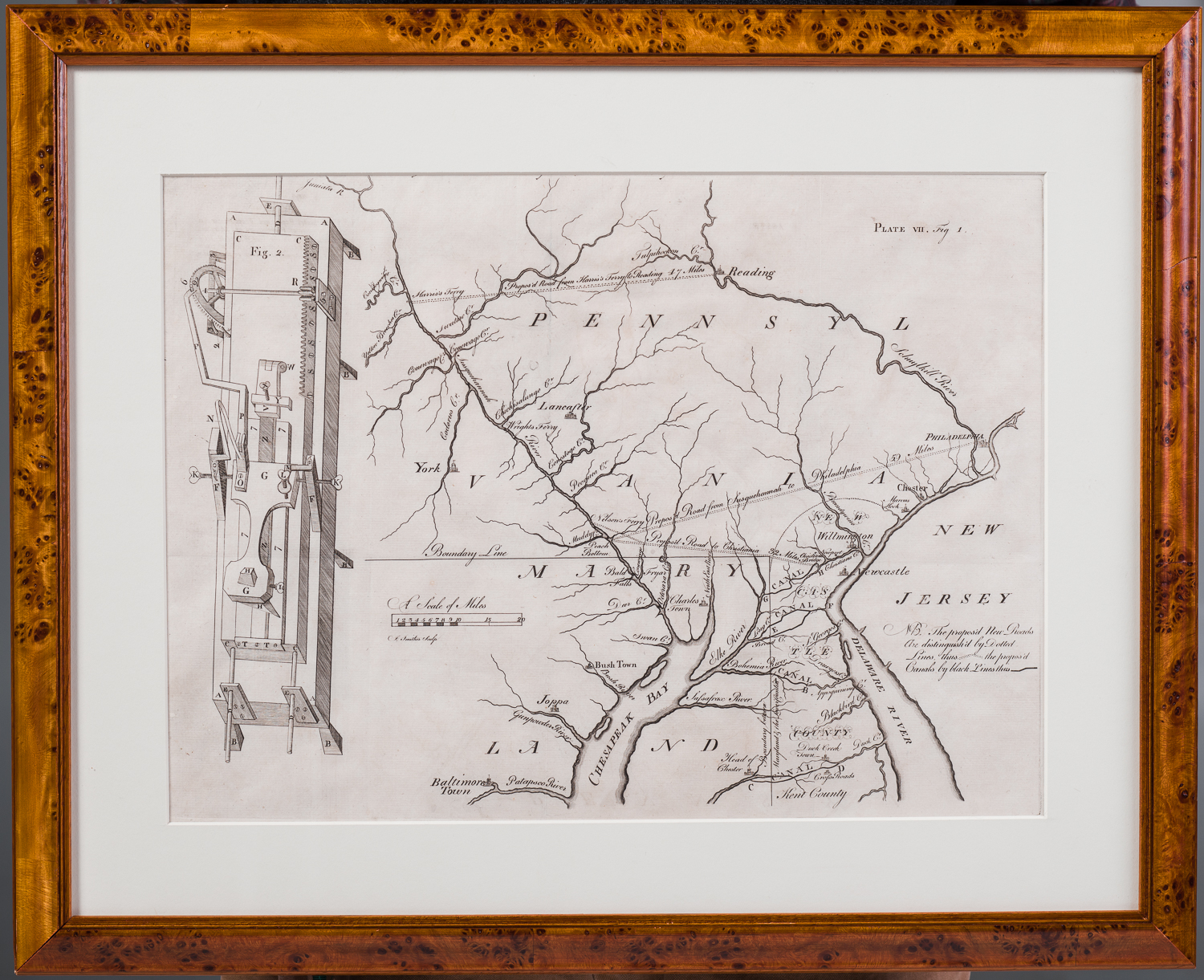
Map “shewing at one view, the several places proposed for opening a communication between the waters of Delaware and Chesopeak Bays.”to accompany “An Abstract of sundry papers and proposals for improving the inland navigation of Pennsylvania and Maryland…”
Engraved by James Smither
Published by the American Philosophical Society in Volume One of its Transactions
Philadelphia, 1771 [State One]
Plate: 12 ½” x 16 ¾” Framed: 19” x 23 ½”
Commentary: According to Wheat and Brun’s Bibliography of Maps and Charts Published in America Before 1800, this map and the abstract that it accompanied were the work of the Committee for American Improvements which had been appointed by the Society. The Committee’s purpose was to study the most desirable network of roads and canals connecting the navigable waters of the Delaware and Susquehanna rivers. A manuscript map was presented to the Society May 18, 1770 by Thomas Fisher and subsequently ordered by the Society to be engraved and printed. On the same plate was included a perspective drawing for a machine for cutting files that illustrated another article in the Transactions.
The same map was issued as a broadside in 1772 with the addition of the date in the lower right. It was usually issued with the cutting machine trimmed off. In 1789 a third state appeared with “Turkey Point” added at the mouth of the Elk River and an island at the head of the Chesapeake Bay identified as “Pursusey Isl.”
The map is in excellent condition.