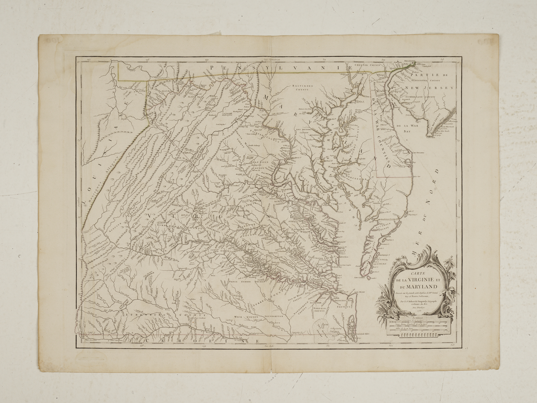
Map of Virginia and Maryland
Engraving with hand colored outline
Published by Gilles Robert de Vaugondy
Paris, 1755
22” x 30”
The most important map of Virginia since the Smith map of 1612, Joshua Fry and Peter Jefferson’s survey and map was the most accurate available until after the Revolutionary War era. First published in London by Thomas Jefferys and Robert Sayer ca. 1753 it quickly appeared in a French version dated 1755 published by Robert de Vaugondy (1688-1766). The map was used widely in the colonies and continental Europe as a source of military and political information from the French and Indian War through the American Revolution. The English version, which had been commissioned by the Board of Trade, does not seem to have been published in large quantities until the 1775/1776 editions ensuring that the version published by Vaugondy in his Atlases would be the most widely disseminated.
In this French edition of the map many of the place names are in English. It appeared in a single folio sheet rather than the four sheet London map and was included in Vaugondy’s Atlas Universale and offered a detailed depiction of Virginia and Maryland westward to the Alleghany Mountains.
This copy, an example of the map’s first state of the first French edition, marked “Gravee E Haussard” was engraved by Elisabeth Haussard, one of the first woman to engrave commercially. The western and southern borders of Pennsylvania are shown and the western limits of the Fairfax grant, eliminated in later editions, are clearly delineated.