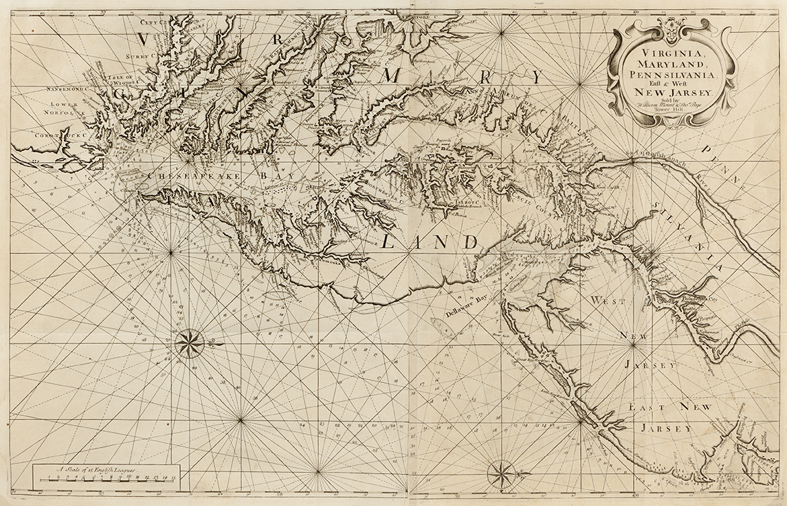

Virginia, Maryland, Pennsylvania, East & West New Jarsey
Sold by William Mount & Thos Page, Tower Hill
London
Two Sheets 31 5/8” x 20 ¼” (plate) with good margins
State one of the second edition, circa 1742
First published in The English Pilot, London, 1689 – an atlas described by William Cummings as having a “complicated history” with some thirty seven editions – this map of the Chesapeake Bay region remained a key chart for the American sailor for nearly a century. “For the first time an English sea atlas presented charts of the whole eastern seacoast of North America. To modern eyes the charts are crude and sparse of detail, but to the navigator of American waters in that period it was his bible.”[i]

Blow up showing level of detail.
The map’s first edition was originally issued by John Thornton and William Fisher and went through five revisions. A second edition was published in 1742 by their successors, William Mount and Thomas Page. This map represented a reversal of the historic pattern of English mapmakers copying the Dutch publications and was widely influential in representations of the Chesapeake Bay produced throughout the eighteenth century.
Price: sold