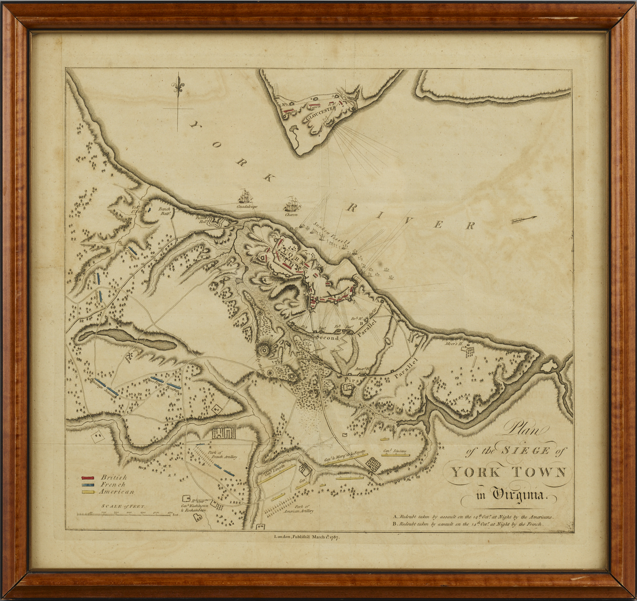
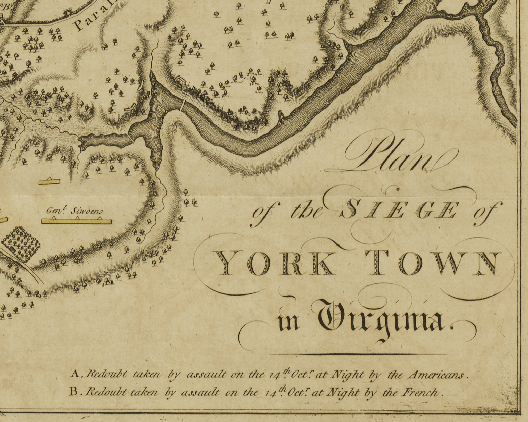
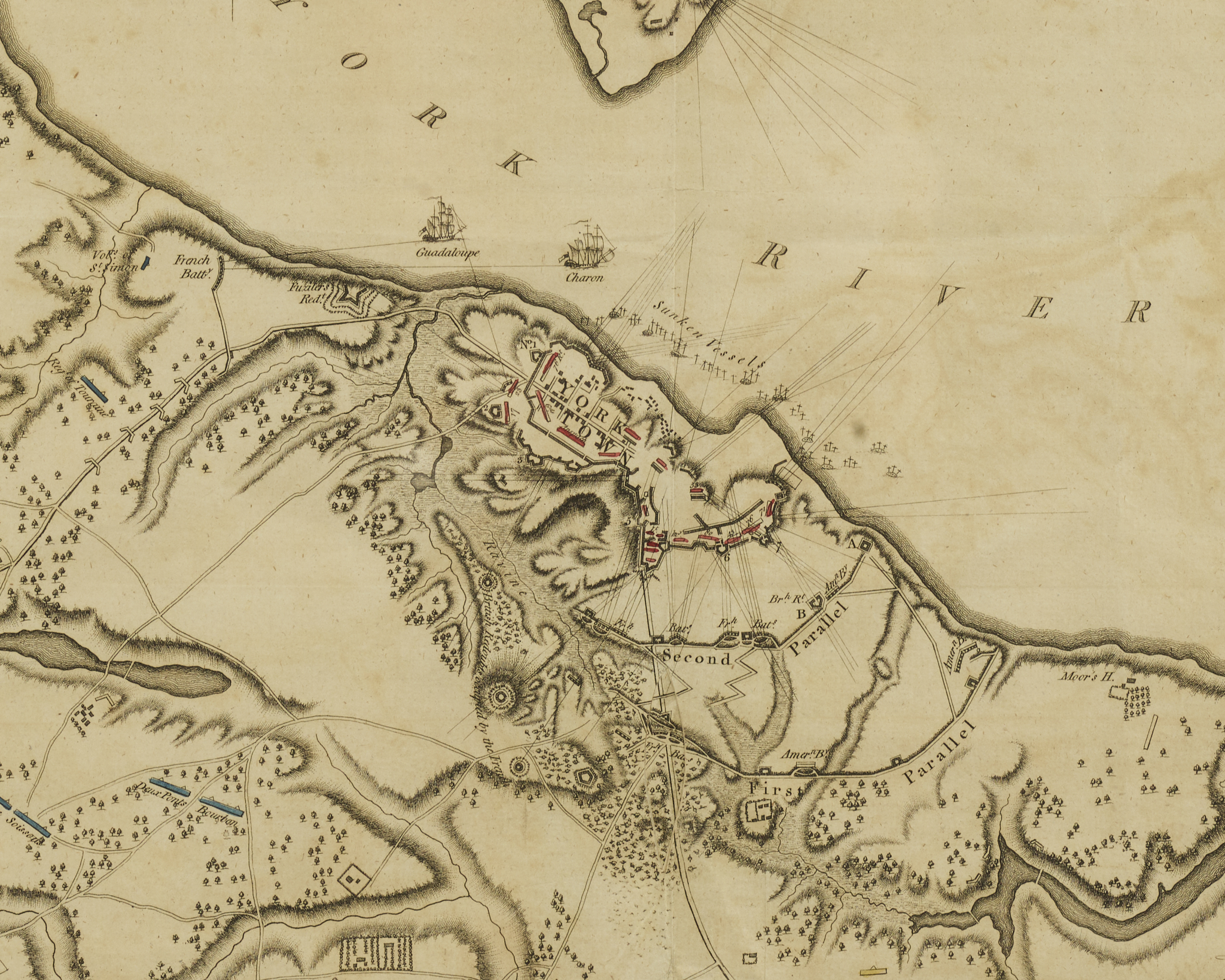
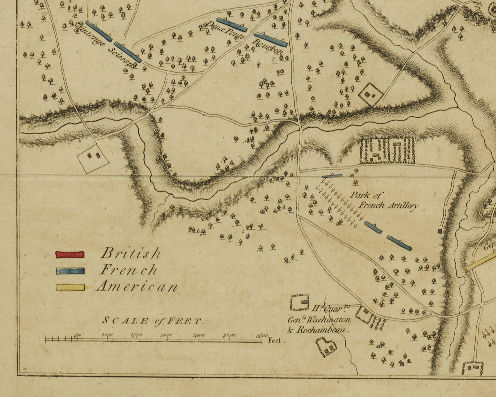
Map of the English, American and French Positions at Yorktown
Engraving
London
1787
Original hand colored indexing
13.5″ x 14.5″ overall
The British printed maps of the siege at Yorktown were taken from two prototype maps, both based on surveys by a British officer on the scene at the time of the battle. One was prepared by DesBarres in 1782 with the second produced by Wm Faden in 1785 notes Coolie Verner in his “Checklist of the Maps of the Yorktown Campaign”. (Mapping of America, R.V. Tooley) This map, XVII, 16.1787, appeared in Tarleton’s A History of the Campaigns of 1780 & 1781 published in 1787. Nebenzahl, #197. Although the scale is small, the map is very well engraved and clearly delineates the terrain and indicates the positions of the combatants. terrain. A legend shows the colors used for the French, British and American troops.