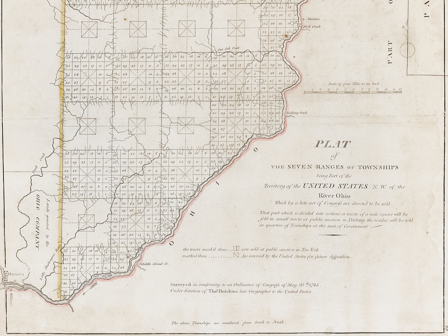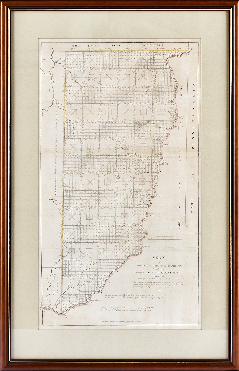
Plat of the Seven Ranges of Townships. Being part of the Territory of the United States N.W. of the River Ohio which by a late act of Congress are directed to be sold…
Engraved map after surveys by Thomas Hutchins
Published by Mathew Carey in his General Atlas, Plate 28
Philadelphia
1814
20.5″ x 31.5″ overall framed
This important early map of Ohio was created under the direction of Thomas Hutchins, the first and only official Geographer to the United States. It was laid out in accordance with the Ordinance of 1785 and was instrumental in setting out the pattern of township grids that would be commonly utilized in organizing subsequent territories and states as the country expanded westward.