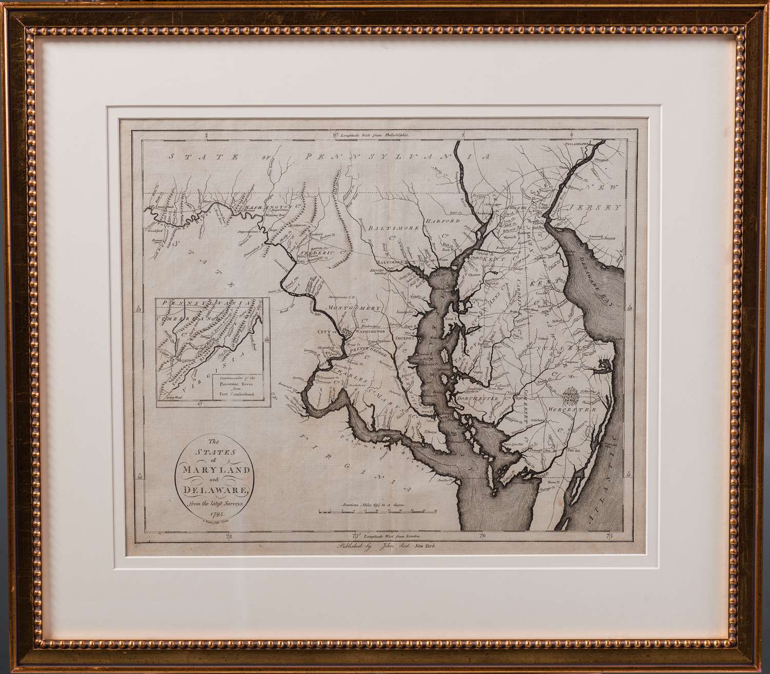
The States of Maryland and Delaware
John Reid publisher
D. Martin engraver
New York
1795
Published in John Reid’s American Atlas, 1796
The first American Atlas was published by Mathew Carey of Philadelphia in 1795. It included a map of Maryland by Samuel Lewis that was drawn largely from Morse’s American Geography and Gutherie’s Modern Geography both of which based their depiction of Maryland on the Fry-Jefferson Map. The Lewis map was copied extensively by other publishers often without attribution. This was the case with John Reid who published his American Atlas, the second to be published in the United States, in 1796 with the Lewis map re-engraved by D. Martin.
The map includes an inset of the continuation of the Potomac River from Fort Cumberland and is one of the earliest obtainable maps of Maryland and Delaware printed in the United States.
Condition: Strong impression in excellent overall condition framed to archival standards.