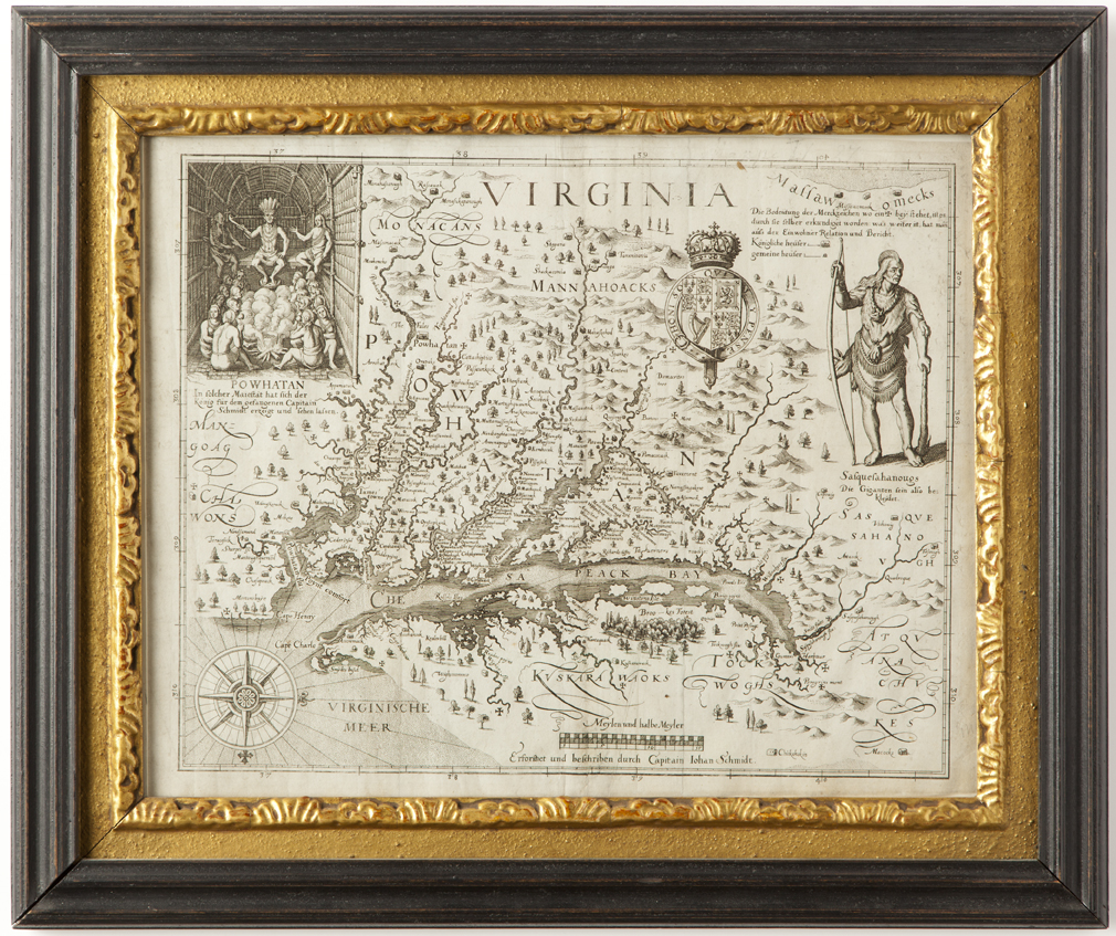

Virginia, engraved map
Matheus Merian after John Smith
Frankfort, Germany
1627
Commentary: Smith’s map of Virginia and the Chesapeake Bay, based on the 1608 surveying expedition of the region, which he led, was first published in 1612. The party explored and mapped large portions of the Bay over a period of three difficult months, producing a remarkably accurate survey. Burden calls the Smith map One of the most important maps of America ever produced and certainly one of the greatest influences. It became the prototype of the area for half a century. A series of maps, which drew entirely or in part on the Smith map, were produced by cartographers in England, the Netherlands, Italy, Germany and France, which rapidly spread information about the fledgling colony across Europe. Our map, published in Frankfurt in 1627 in Theodore De Bry’s Grand Voyages, while chronologically the third derivative of the Smith map, is the earliest full size derivative of this foundation of Virginia cartography. By the time of its publication, the family publishing business had passed from De Bry, who died circa 1623, to his son-in-law, Matheus Merian.
Tooley, Mapping of America, pp. 163-4
Burden, The Mapping of North America, #219, pp272-3
Mackay, et.al, Changing Perceptions, page 12
Condition: The map is in very good condition and has been backed with rice paper.
SOLD